


Amy Martin has compiled the ultimate nature app guide. Photo courtesy of StarWalk. This article originally published Aug. 8, 2016.
![]() Ever seen someone out in nature with the nose to a smart phone? It may not be a case of social-media addiction. More likely they’re using an app to enhance their outdoor experience. Whatever your nature need, there’s an app for that.
Ever seen someone out in nature with the nose to a smart phone? It may not be a case of social-media addiction. More likely they’re using an app to enhance their outdoor experience. Whatever your nature need, there’s an app for that.
My iPhone is an integral part of my nature experience. It gets me to my location, answers questions, identifies things and captures experiences. It goes far beyond the identification apps like LeafSnap for plants and those from Audubon for birds, or ones that allow you to also report your sightings like iNaturalist, iBird and others. There are oodles of map apps for parks and trails. You can even track river conditions. Stargazing apps are easy: just point them at the night sky and star maps reveal what’s up there.
Some apps are just books in phone form. Other apps, especially for parks, simply mirror the website. And a few are apps that process data. Some require wi-fi or cell-phone connectivity. All have their uses. Let’s take a selective tour. Share your favorites and feedback in the comments.
TEXAS STATE PARKS
Few state’s natural offerings are as well covered, app wise, as Texas.
 Texas State Parks
Free
Texas Parks & Wildlife was already tech savvy before the app era, so it was a natural for them. Their app reflects the website with a drill-down search through the state park. Bright and open, but very simple, graphic style. Searchable by location and interest, you can even book campsites and cabins by phone. It’s a great way to get park specs on the fly, but then I am a state-park addict compelled to check out each one I come across.
Texas Parks & Wildlife Magazine
Free
The apps’ articles are an excellent way to deepen experience of area you visit, nicely grouped by popular features on fishing, hiking or state parks, for instance. It’s easy to browse last few issues of features. But the app has additional info not featured in the magazine, plus all of Texas Parks & Wildlife fine videos. Visually soothing graphics that are small but bright. You might luck upon a great in-depth article complete with trail tips. The magazine has been around for decades, so there’s a good chance of that. You need to be subscriber and sign in to access all the data, but it’s $15 or less a year and you should be supporting your park system anyway.
Pocket Ranger: Texas Parks Guide
Free
Like many freelance park apps, this one mirrors the official website, but includes more color graphics and a few ads. The GPS maps and weather info connection for each park are a great addition. Some may like interface better, though the booking is not as smooth. This apps line might be more of an improvement in other states lacking the techno snap of Texas Parks & Wildlife.
MAPS
Find out every physical detail about your destination, plus how to get there.
Free
It’s amazing how far plain old Google maps can go. Satellite view shows what an area looks like from overhead and terrain view displays basic topography. Street View, accessible once a location is clicked on, can give you 360 views and sometimes Google even shoots park campgrounds so you can zoom in and check out individual cabin or camp sites. Scroll down to access reviews and photos submitted by users.
Free
Google maps on steroids. What a space hog. But then it will literally take you through the universe and all over the Earth. Cool sweeping 3-D views of many metropolitan areas, including their parks. More buggy than Google maps and the interface takes some patience, but once you learn it’s seamless.
 HIKING AND BOATING TRAILS
Finds trails and every detail about them. Many park apps have great guides to their trails.
Free
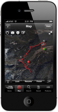
The be all and end all of trail apps. It’s Tinder for trails, letting you know what’s nearby and open. Over 300,000 trails, hikes and bike routes, you can search by type, activities and length. Complete info on trails: trailhead location, length, difficulty, potable water, shelters and more. User submitted stories, tips and photos. Best of all, it can track your route, distance, speed and elevation, and you can save a map of your wanderings.
Trailhead by North Face app
$3.99 to free
Not so good on locating trails, but great on tracking them. Almost like a wearable fitness app in the intricacy of the way it presents the data. The heat maps are quite useful. Vast topographic map library in the pro version. Works best with Apple Watch.
$3.99 to free
A must for any type of boater, it’s vital for floaters on flash-flood prone bodies of water. River monitoring by USGS gauges merged with water flow data from NOAA. Now updated to include the popular Pecos and Devils Rivers are gauged by IBWC. Hat tip to Richard Grayson.
Free
A big hit among the hike and bike set, with over 3.5 million downloads. Super easy to find and search for type, difficulty, and length among 50,000 trails. Ability to save and customize existing trail maps, and not just add notes, is a great feature. Vigorous user feedback includes unofficial trails. Complete route tracking of elevation, distance, time, and speed per mile.
Free
The app maps over 20,000 places that allow access for canoes, kayaks and stand-up paddles to enter rivers and lakes. Provides basic info on ramp, location, parking and if fees are incurred. User feedback and photos refine aspects of the launch sites, as well as the on-water experience. A bit buggy, but getting better.
 NIGHT SKY
The sky is half the landscape.
$2.99
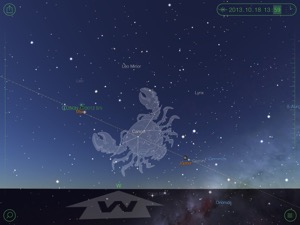
Lots of astronomy apps out there, particularly ones meant just for kids, but Star Walk is the hands-down winner for adults with more than 10 million users. Just point your device at the night sky as if taking a photo and on the screen will appear the Moon, stars (plain, identified or with constellations outlined), planets, nebulae, star clusters and even satellites. Immense stores of information on celestial bodies, especially the Moon. Use the Time Machine function to see the night sky in the past or future. Plus it’s beautifully designed and easy on the eyes at night. Even has a space-music soundtrack option.
Point your StarWalk app at the night sky to get quick astromical IDs.
 Pocket Universe: Virtual Sky Astronomy
$2.99
A good mid-range app for relative newbies to stargazing. Easy to track Moon phases and pass-overs by the ISS and satellites. Quizzes, games and way cool orbital animations.
$2.99 to free
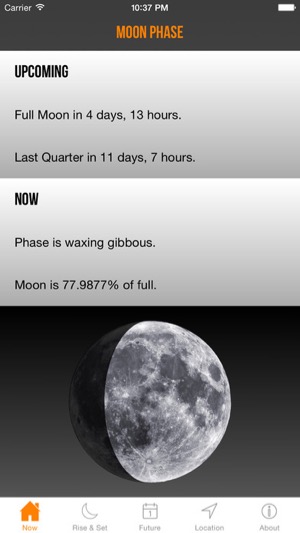
There are lots of Moon phase apps available, but this is my fave and Moonlady is my nickname. Great presentation of precise data, including rise and set times for Sun and Moon. Even shows how the interim phases look in the sky; for instance, if the Crescent Moon tips will be pointing up or down. Plus it howls when the Full Moon phase begins!
Amy "Moonlady" Martin's favorite moon app is Moon Phase.
WEATHER
Nothing bums out a hiking excursion quite like being caught by surprise in bad weather.
Free
Very user friendly. Best for cities. Lots of weather extras like photos, pollen, pollution and game day forecasts. Alerts for severe weather, hurricane and tornados. The traffic cam links are very handy for checking your travel route.
 The Weather Channel
 Free
All the stuff that Weather Bug has, but with irritating pushes of sensational weather news. Oh joy.
Free, $1.99 annual to be ad free on app and website
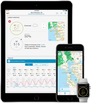
Weather nerds rejoice. This is YOUR app. Great when you know how to read radar, storm tracks and atmospheric statistics. Fast efficient weather info when you need it. Great reams of data when you want it. Tap into individual weather stations for extremely localized data. Covers basic astronomy like Sun and Moon rise and set times. All kinds of alerts. The website version rocks.
Weather Underground app is recommended for weather nerds.
PLANT IDENTIFICATIONS
Even more plant identification apps than listed available from Audubon. Hoping for The Sibley Guide to Trees to be released in app form.
 Botany Buddy
$9.99 to free
Nearly 10,000 images of more than 2,000 native and ornamental plants, trees and shrubs, including cactus, succulents and tropical plants. Search by common or botanical name, type, shape, leaves, flowers, buds, bark, fruit, fall color, Sun exposure, water use, habitat, hardiness and more. Plant community with information sharing and identification help.
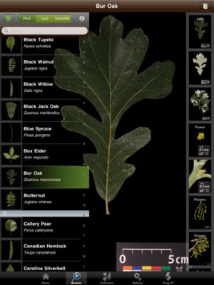
Leafsnap app uses your smartphone camera to ID trees
Free
Snap a pic; identify a tree. Visual recognition software helps identify tree species from photographs of their leaves. Still in development, it’s not greatly comprehensive, covering only trees from a few regions of North America and focusing on leaf, flower and fruit. But jump in and participate to help develop the visual recognition software.
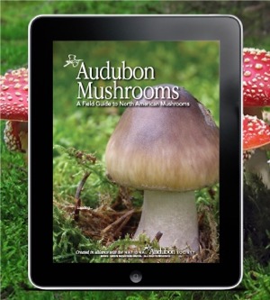 Audubon Mushrooms Guide
 $3.99
How not to die from eating wild mushrooms of North America. Plus fungi and slime molds, but don’t eat those.
$3.99 to free
If you’re really into mushrooms, you’ll want this one recommended by Merriweather Foraging.
$3.99
Identification plus a sighting journal option.
Free
Learn about invasive plants ruining our ecology and report them.
BIRD IDENTIFICATION
Birders led the way on nature identification apps and they continue to ace the field. Oh the thick, narrow field guides we used to schlepp about. Now guide books for every region in the world can fit in the palm of your hand. Many are highly specialized and pricey, but come in free “lite” versions to get you started. Good ones include audio of birdcalls. Still waiting for the bird poop app though.
$19.99 to free
Yeah, pricey, but if you are a bird nerd or wanna be it’s a must. Vast worldwide info divided into regions. Learn that bird along with its habitat, behavior and more. In depth, yet friendly to the newbie. Searching to identify is easy and intuitive. Authoritative and respected with more than two-million downloads, it links easily with eBird. Photos galore, range maps and migratory routes, lots of bird calls. Log and keep track of your sightings, and learn of notable bird sightings, including rare birds. Audubon also has apps just on owls and hummingbirds and specific geographic regions.
 iBird
iBird$19.99 to free
Most popular of the bird apps that cover more than 900 species of both native and rare North American and Hawaiian birds, it comes in specialized versions that save space on your phone. Perfect for casual birders is iBird Yard focusing on birds that enjoy feeders, plus a few raptors. It goes from there through several levels of difficulty up to iBird Ultimate, which features bird ID algorithms and all kinds of bird nerd stuff I can’t begin to understand. The Birds Around Me function makes it Tinder for birds. Marvelous interface is super user friendly and the app is very consumer sensitive, constantly adapting and improving via feedback. For those who keep life lists, iBird Journal app is the thing.
Sibley eGuide to Birds of North America
$19.99 to free
The Sibley Guide to Birds of North America same on the scene a while back and overtook other bird identifiers in popularity with over 6600 drawings of birds that show them engaged in flying, perching and eating—real world birding. He took a modernized way of presenting behavior and habitat. The app has the entire book text, plus the largest library of bird calls available to the public. Super searchable. Good personal sightings log.
ANIMALS AND INSECTS IDENTIFICATION
There are many apps for wildlife identification. Some are quite specialized, like those for insects and spiders. But most are classroom informational rather than what you need to know about wildlife while in the field. Many are highly specialized and pricey, but come in free “lite” versions to get you started. Good ones include audio of animal calls. Audubon series includes Reptiles and Amphibians, Insects and Spiders, Butterflies, and Mammals. Or go all in with their Ultimate Nature Guide that features them all, including birds and plants; enter where you plan to go and it will pull the info you need.
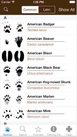 iTrack Wildlife
$14.99 full, $4.99 basic
Often all you see of wildlife are tracks. High-resolution photos and drawings includes some skulls. Good concise info.
iTrack Wildlife app
$9.99 to free
An app version of best-selling Princeton field guide to the land and marine mammals. Includes some calls. Can even enter a zipcode to find what wildlife lives there. Side by side comparison of mammals. Some animal calls.
NATURALIST NETWORKS
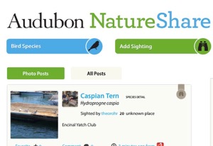 Citizen scientists are improving conditions for wildlife by providing data to wildlife biologists and others through their sightings, enabling scientists to understand wildlife migratory patterns and more. They use that information to make a case for preserving animal habitat. If you see wildlife you don’t recognize, submit a photo the app community will happily identify it for you. Automatically enters the date and your location, if desired, to make recording observations easier. Lots of room for notes. Also enables you to meet and connect with other naturalists. The sites below are free.
TOOLS AND TIPS
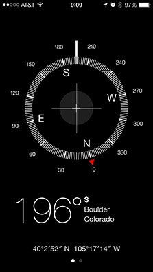 Compass
Most smartphones have a built-in compass. On iPhone, swipe the compass to the side and a level is revealed.
Memory
Before hiking trips I clear all apps from my phone except those I need for travel, since several of the nature apps are space hogs with extensive data. Someday I will master the cloud, but that doesn’t help much when there’s no signal. Wish I’d saved my old smartphone just for app use on the road.
Phone Covers
Don’t go hiking with conventional smartphone covers. Make sure the phone is well sealed against dust, which means looking for water resistant covers. Rubber gaskets that protect against breakage also help keep out dust. My favorite case is Cliphanger that enables you to hang your phone from a belt loop or attach to a strap.
Voice Recording
Many people have seen me talking to myself while walking trails. Not crazy, OK maybe a little, but I’m really taking notes on my nature experiences. If rushed, I use the iPhone Voice Memos function and chatter away. But the Notes app has voice to text capabilities, and if you speak slowly and clearly it saves lots of transcribing time. Several recording apps do as well.
Sign up for the weekly Green Source DFW Newsletter to stay up to date on everything green in North Texas, the latest news and events. Follow us on Facebook, Twitter and Pinterest.
Author

AMY MARTIN
Amy Martin, a journalist and writer for more than 40 years, is a senior reporter for GreenSource DFW. Her latest book, "Wild DFW: Explore the Amazing Nature in and round Dallas-Fort Worth,” (Wild-DFW.com) will be released by Timber Press in July 2023. She is currently creating a biographical website (NedFritz.com) of Ned Fritz, Texas' most famous environmentalist. Her prior book was "Itchy Business: How to Treat the Poison Ivy and Poison Oak Rash, Prevent Exposure and Eradicate the Plant.”(Itchy.biz) She was contributing editor for the national magazine Garbage (recycling and features), and has written for TheaterJones (comedy and cirque), Senior Voice (The Aging Hippie column), Dallas Morning News (recycling), Dallas Times Herald (performing arts), and Dallas Observer (music and comedy). For a dozen years, Martin also operated a popular alternative news service called Moonlady News, earning her the nickname Moonlady. She may be reached through Moonlady.com.